
The Pennsylvania Signers
by Diana Loski
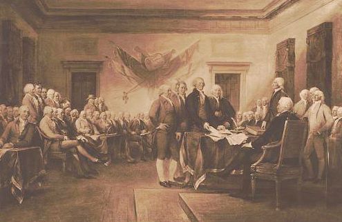
The Signing of the Declaration
(Library of Congress)
Of the fifty-six signers of The Declaration of Independence, Pennsylvania provided the most signers, nine in all. Additionally, Pennsylvania gave our new nation the eldest signer, the first of the signers to die in the Revolution (nine in total did not survive it), the signer who provided the financial intellect behind the funding of the American Revolution, the signer who became one of the first justices of the Supreme Court, and the signer who introduced George Washington to flag-maker Betsy Ross. In honor of the semi-quincentennial of the United States, here is a glimpse of the nine signers of the famous Declaration from the Keystone State:
Benjamin Franklin. A Bostonian who adopted Pennsylvania as his home, Franklin was the most colorful of all fifty-six signers, as well as the oldest. He was seventy years old when he signed the Declaration. Already a well-respected statesman, inventor, printer, author, and scholar, Franklin was a keen observer of humanity and was a voice of reason amid others of a more heated temperament. Fortunately, many colonial delegates listened and were persuaded by him. Franklin served on the committee of five who were tasked with creating the document, along with John Adams, Robert Livingston, Roger Sherman, and Thomas Jefferson. While Jefferson was elected to write the Declaration, Franklin offered the young Virginian advice on wording and semantics. The phrase “We hold these truths to be self-evident” was one of Franklin’s offerings.
Eleven years after signing the Declaration of Independence, Ben Franklin also signed the Constitution. Overcome with gratitude and thrilled at the prospect of self-government, he wept as he signed it. He died in 1790, at the age of 84, and is buried within walking distance of Independence Hall in Philadelphia, at the Christ Church Burial Ground.
Robert Morris. Born in England, Morris emigrated to the colonies as a child, accompanied by his father. Orphaned a few years later at the age of sixteen, he quickly learned to fend for himself. He was especially adept at finance and soon built great wealth in the business sector. He was considered a financial genius. He opposed the fight against his native country at first, but soon became convinced to sign the Declaration. He used his immense wealth to help fund the American Revolution, and encouraged others with wealth to do the same. It was a great help to the Continental Army, as there was no centralized government to help with the war effort. One fellow Pennsylvanian who hearkened to Morris’s call for funds was Samuel Gettys, whose son James later established the Borough of Gettysburg.
Because Morris owned many ships due to his businesses, he helped provide necessary food and equipment for the struggling Continental Army. As the war continued for many years, the British soldiers were determined to punish Robert Morris for aiding the Americans. They burned his estate in Philadelphia. Morris spent all his wealth helping to build the nation. He later signed the Articles of Confederation and the U.S. Constitution – one of only two Founding Fathers to sign all three documents (the other was Roger Sherman from Connecticut).
Morris never regained his wealth, but he never regretted using his treasure to build the new republic. He died in 1806 at the age of 72.
George Clymer. A Philadelphia native, George Clymer was born in 1739. He was an avid reader and was especially interested in history. He became a wealthy merchant in Philadelphia. A noted abolitionist, George also was vehemently against British taxation and stood determinedly against the unfair Stamp Act. He was elected to the Continental Congress and was one of the earliest advocates of independence. His friend and fellow advocate Robert Morris secured his agreement to help fund the revolution. After the war, Clymer was one of the signers of the Constitution. He died in 1813, at the age of 74.
George Ross. Born in Delaware, George Ross came to Lancaster, Pennsylvania as a young man and studied law. He served for many years as the Crown Prosecutor in Philadelphia, representing King George III. Nevertheless, he was a strong advocate for independence after the many unfair acts of the king. He was elected in 1776 to the Continental Congress in Philadelphia, and was not present on July 4, 1776 when most of the signers affixed their signature to the document. He arrived on July 20 and signed the document on August 2.
George Ross was related by marriage to the upholsterer and seamstress Betsy Ross. His nephew, John, married the Quaker Elizabeth Griscom in 1773. The couple lived in Philadelphia, and by most accounts, history avers that it was George Ross who introduced General George Washington to his niece to create the flag for the new United States of America.
Sadly, both George Ross and his nephew, John, did not survive the Revolutionary War. John was killed in an explosion of ordnance in 1776, and George died of illness in 1779 at the age of 49.
Benjamin Rush. A respected doctor as well as a statesman, Dr. Benjamin Rush was born just outside Philadelphia in 1746. A man of considerable intellect, Rush spoke four languages fluently and graduated from the yet future Princeton at the age of 14. After an extended visit to Europe, Rush returned to Philadelphia to set up his medical practice. A true humanitarian, he was one of the leading proponents against the institution of slavery.
In addition to affixing his signature to the Declaration of Independence, Dr. Rush served as a surgeon for the Continental Army, putting his life in jeopardy countless times on the fields of battle. After the war, he was instrumental in the establishment of Dickinson College in Carlisle, Pennsylvania. Equally adept at chemistry, he taught medicine at the University of Pennsylvania and served as the Treasurer of the U.S. Mint in Philadelphia before he died in 1813 at the age of 67.
John Morton. A farmer and surveyor, John Morton was born in 1725 near Philadelphia. A man who had many friends, Morton was elected as a juror, justice of the peace, and sheriff of his county. When he was elected to the Pennsylvania Legislature, most of those who had elected him to the position were loyal to King George III. When the topic of independence required a vote, Morton agonized over the decision. While he personally advocated independence, many of his constituents did not. He finally cast his vote for independence, and signed the Declaration. He never lived to see the fruition of his efforts. Less than a year later, in June 1777, John Morton died of tuberculosis at the age of 52. He was the first of the signers to die during the American Revolution – although his death was not caused by the British.
James Smith. Born in Ulster, now Northern Ireland, James Smith was just eight years old when he traveled across the Atlantic with his parents and settled in Chester County, Pennsylvania. An Irish national, Smith grew up with great animosity toward England’s King George III. A surveyor during the early years of his life, James became a lawyer and practiced in the town of York, Pennsylvania. Elected to the Pennsylvania Legislature, James was not only eager to sign the document, but asked for a copy of it so he could take it back to York and read it to the citizens of the town – which he promptly did.
When the British quartered in the city of Philadelphia during the winter of 1777-1778, the Continental Congress had to find another place for their headquarters. Smith convinced them to stay in York. James’s town became the capital for the time being, and many meetings were held in the home of James Smith.
After the war, James served as a judge and leader of the militia in his hometown of York. He died there in 1806, at the age of 86.
George Taylor. A true example of rising to one’s potential, George Taylor was born in Ireland in 1716. An orphan, he was determined to escape poverty by boarding a ship to the colonies, which he did at the age of 20. He became an indentured servant to a wealthy ironmaster in Philadelphia to pay for his passage. After several years of this servitude, his master died, and Taylor married his widow. He eventually took over the ironworks and became a wealthy businessman.
When the Pennsylvania Legislature could not get a majority to sign the Declaration of Independence due to some of the loyalists who refused to sign it, George Taylor was elected to the legislature in July 1776. He hurriedly agreed and cast his vote for independence, signing the document with others of Pennsylvania who arrived later, on August 2.
Taylor donated many weapons and munitions from his ironworks to the Continental Army, mostly without any recompense. The stress and constant work for the cause wrecked his health, and he died in 1781, before the end of the war, at age 65.
James Wilson. Born in Scotland, James Wilson never intended to leave his native country. Well educated, Wilson was studying for the ministry in Edinburgh when his father abruptly died, rendering the son penniless and unable to continue with his education. Deciding that going to the colonies was his best option, Wilson crossed the Atlantic and settled in Carlisle, Pennsylvania. He found work at the (future) University of Pennsylvania, teaching Latin.
With his Scottish roots, Wilson was an avid defender of liberty, and published a pamphlet advocating the rights of man and the push for independence. He was elected to the Pennsylvania Legislature, and was eager to sign the Declaration of Independence. Like his fellow signers Ben Franklin, George Clymer, Benjamin Rush from Pennsylvania, and Roger Sherman from Connecticut, Wilson also signed the Constitution in 1787. He also was one of the framers of that later document. James Madison, who is called the Father of the Constitution, had been taught in his youth by a Scottish tutor who taught him about successful governments of antiquity. Wilson, who had also been schooled in Scotland with the same historical knowledge, worked alongside Madison during the Constitutional Convention.
It was a fortunate thing for America that James Wilson decided to leave Scotland for the colonies those many years ago. In 1789, President George Washington named James Wilson as one of the first justices of the U.S. Supreme Court. Wilson used much of his wisdom and love of freedom to set the pattern for future justices. He died in 1798 at the age of 56.
It is easy to take for granted, 250 years later, of the creation of such a document as the Declaration of Independence. In the early summer of 1776, however, the future nation was only a dream, and the acquisition of a self-government of the people was uncertain. The men who signed the Declaration risked their lives in doing so.
One of the members of the Continental Congress from Pennsylvania, John Dickinson, voted against the document, because he felt words were useless without a well-equipped army to back them. He didn’t realize the determination of the American people.
Sources: The Betsy Ross House, Philadelphia, PA. The Constitutional Center, Philadelphia, PA. Allison, Andrew M. Benjamin Franklin: Printer, Philosopher, Patriot (A History of His Life). Washington, D.C.: The National Center for Constitutional Studies, 1987. Fradin, Dennis Brindell. The Signers: The 56 Stories Behind the Declaration of Independence. New York: Walker & Company, 2005. Franklin, Ben. The Autobiography of Ben Franklin. Edited by L. Jesse Lemisch. New York: Penguin Books, 1961. McCullogh, David. 1776. New York: Simon & Schuster, 2005. James Gettys File, Adams County Historical Society, Gettysburg.